

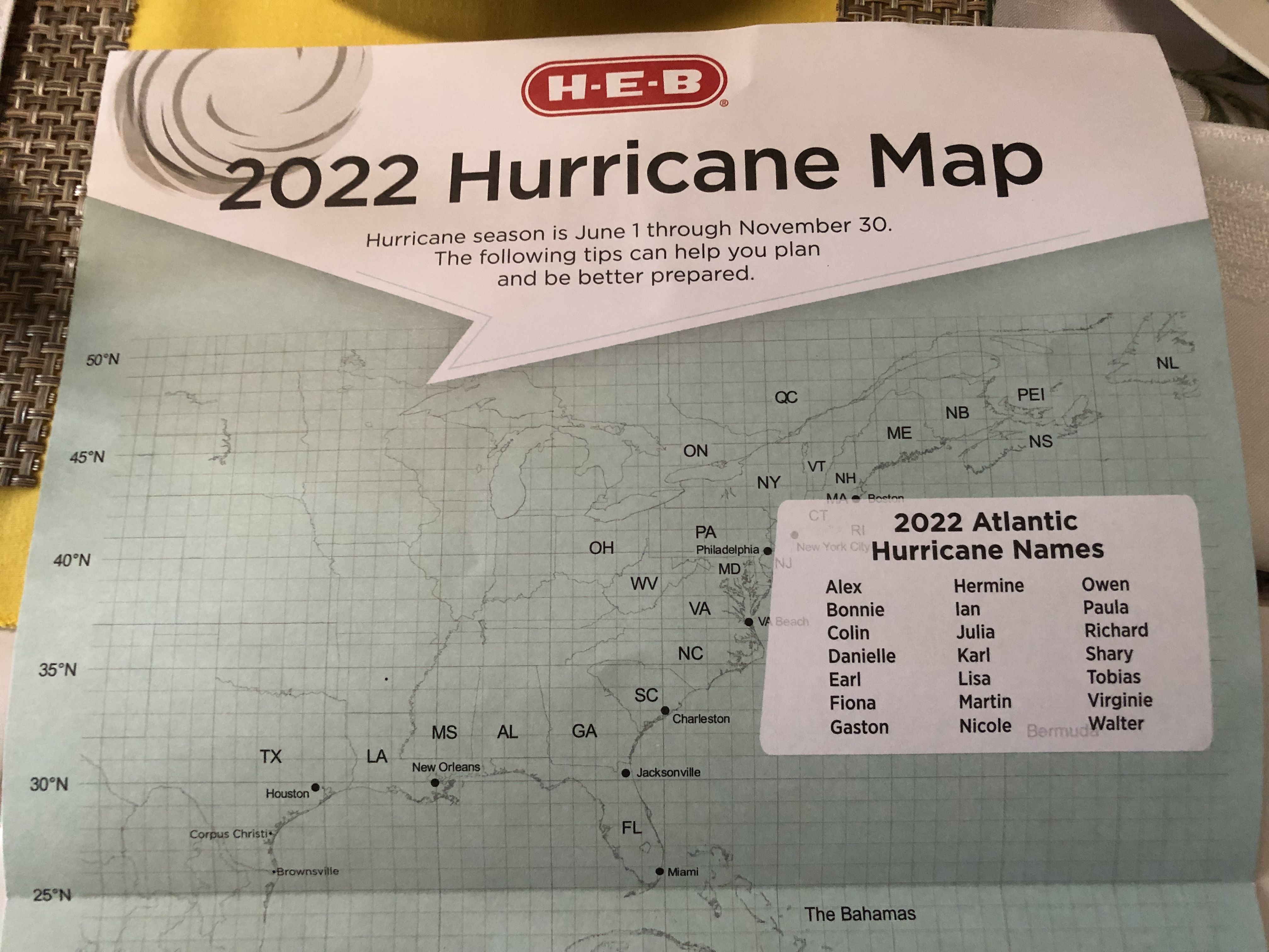
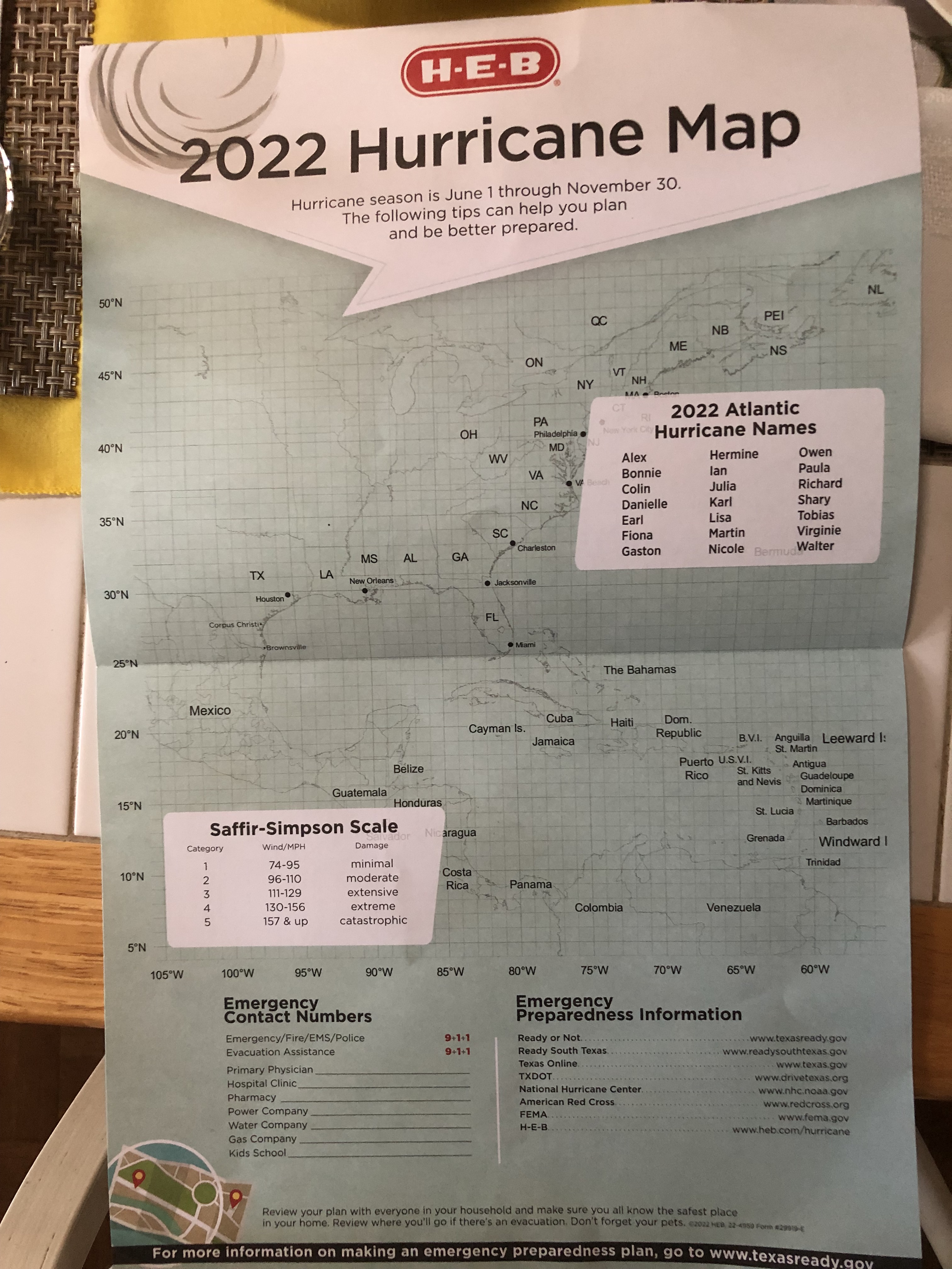
In our digital world I honestly thought paper hurricane tracking maps were a thing of the past. When I found this one in my grocery bag yesterday, I was quite surprised and had a quick memory rush. Hurricanes are intertwined through the years of my life and have always fascinated me. Watching them form and then fizzle or gather strength as they move through the Ocean is just one of planet earth’s many wonders.
Paper hurricane tracking charts were a part of each summer of my life for many years. Today I check the National Hurricane Center website throughout the day if there is any activity in the Atlantic basin worth watching. At each update I cannot only see where the storm is, but read what the hurricane experts are expecting the disturbance to do in the next few hours and stay up-to-date and informed.
In the pre-digital era, I had to hover by the tv set at 6 p.m. and 10 p.m. to get the latest coordinates of the storm (which often were several hours old at the time of the broadcast). Hubby would usually catch them in the morning and then I would plot them on the paper chart – in pencil. After the storm disintegrated or shifted course away from the Gulf of Mexico, I erased the marks in preparation for the next storm. Yes, I had Depression era parents and wasn’t going to throw away a perfectly good paper chart. What if I went to the store and they didn’t have any more, then what would I do? In time I would have to get a new one, but frugality was a deciding factor in erasing the marks and starting over.
The only paper chart I ever saved was when I plotted Hurricane Andrew from mid-Atlantic, across Florida, and then into the Gulf before making landfall near Morgan City, LA. Hubby was working in Biloxi and I was in Texas plotting the storm and calling him with updates. Remember, this was pre-cell phone days and getting instant information on your phone. He and his staff were busy making preparations as the storm was expected to make landfall along the Mississippi Gulf Coast at that time.
Poor Texas boy he was. He had no idea what to do and why it was so important to make preparations. His staff gave him a small assignment and took charge because they needed to get home to make preparations there. When they finished, he and the other execs went inland and found a hotel. Most of the time they were sitting in the hotel bar, doing what you usually do in a bar, and waiting for hurricane updates. After one update, everyone in the room stood up and began shaking hands and slapping each other on the back. Finally, someone said, “let’s go home” and they started leaving. He was startled and asked what they were doing – a hurricane was coming, why were they going home.
They gently explained to him that the storm had turned and would not be coming their way. They were experienced Gulf Coast people and knew if the storm passed a certain parallel it would not make landfall in their area. I laughed when he told me because I knew the coast people were weather wise and hardy souls that had weathered storms all their lives. I kept that chart because of the path of the storm and its category 4 destruction, but mostly to remind me that hurricanes are only predictable to a certain point and can change their minds at will.
As we head into July and an increase of storm activity, I’m keeping the paper chart handy, maybe make a copy or two in case the grocery store doesn’t have any more. I’ve also stocked up on bottled water and have empty water containers to fill if needed, batteries, candles, matches, and everything else (i. e. toilet paper) just in case we do have a storm hit the Texas coast just right. At two hours away from the coast significant damage could occur where I live and it pays to be prepared.

You sound like a very serious hurricane tracker. I am surprised there are paper charts to track hurricanes in thid day and age. You have spoken of many memories in this post – whick was quite interesting.
LikeLiked by 1 person
Thank you, Peggy!
LikeLiked by 1 person
I never even heard of paper hurricane tracking maps. I have always lived in the St. Louis area. I, too, am surprised that they still sell these paper maps. Stay safe!
LikeLiked by 1 person
I was surprised, too! The maps are free, but if they run out they are out for the season.
LikeLiked by 1 person
Good to plan ahead! I enjoyed the map story.
LikeLiked by 1 person